Hike Spokane: Best Trails & Tips
No experience is more tranquil, rewarding, and memorable than waking up early to watch the sunrise from a peak surrounding Spokane. Seriously, it can be a life-changing moment. Some of my favorite memories are of doing just that – waking up early to race the sunrise to the top of a mountain peak with my son and our faithful Australian Shepherd, Indy (see picture below).

I hope you can have the same experience, so I wanted to share some quick resources with you to help you get started. Could you do me a favor, though? When you have a chance to enjoy an experience like the ones I’ve described, could you send me an email to let me know? I’d love to hear about it and celebrate with you!
Spokane Hiking Resources
When my family and I first moved to Spokane, our realtor knew we were excited about the many outdoor opportunities in the area. He gave us a book of trails in the Spokane, Coeur D’Alene, and Sandpoint areas, and it’s amazing! The book is written by Seabury Blaire, Jr. and is titled Day Hike!: Spokane, Coeur D’Alene, & Sandpoint. I recommend it to anybody looking to enjoy the beautiful nature around Spokane. Since living in Spokane, we’ve learned about many other hiking resources like Visit Spokane’s Hike Spokane webpage, the Washington Trails Association Hikes Within 30 Minutes of Spokane webpage, and AllTrails.com.
Equipment Needed
There isn’t any need to be complicated with hiking these trails. Honestly, all anybody really needs is a bottle of water (about 20 oz.) for each hour you plan spending on the trail. Heck, even shoes are optional for some of these trails, but I would personally recommend shoes. 😊 Simply grab some water, lace up, and go explore. If you have a friend or two to go with you, even better!
Where to Go?
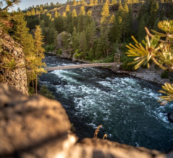
Using the links that I’ve shared above, here is a quick list of some fun trails for you to check out. All these trails with the exception of those on Mount Spokane are located within about 20 minutes of campus. My personal favorite is Big Rock/Iller Creek. I’ve included some rough mileage estimates and a general challenge level. Remember, it’s about connecting to the beautiful Inland Pacific Northwest, so you can’t make a bad choice.
| Trail Name | Mileage | Challenge Level |
| Antoine Peak | 5.5 miles | Medium |
| 2.5 miles | Easy | |
| Big Rock/Iller Creek | 5.0 miles | Difficult |
| Bowl and Pitcher Trails | 2-6 miles | Easy-Medium |
| Dishman Hills Loop | 5.5 miles | Medium |
| Knothead Loop | 7.0 miles | Medium |
| Liberty Creek Loop | 8.4 miles | Difficult |
| Little Spokane Out-and-Back | 4.9 miles | Difficult |
| McLellan Conservation Area | 3.4 miles | Easy |
| Mica Peak Conservation Area | Varies | Difficult |
| Mount Spokane Trails | Varies | Difficult |
| Palisades Park | 4.4 miles | Easy |
| Pine Bluff Loop | 5.2 miles | Difficult |
| Saltese Uplands | 3.6 miles | Medium |
| Slavin Pond Loop | 3.3 miles | Easy |
| Spokane House | 2.5 miles | Easy |
When Should I Go?
NOW! Plan your adventure and go as soon as you can. Don’t forget to let me know if any of these resources helped you to have an experience that you’ll never forget.
Happy Trails!
Steve